
Mount Rinjani Hiking Routes via Torean and Senaru Are Closed, Here Are Alternatives for Hikers
Wednesday, 30 September 2026 | 13:00
Author: Arif S

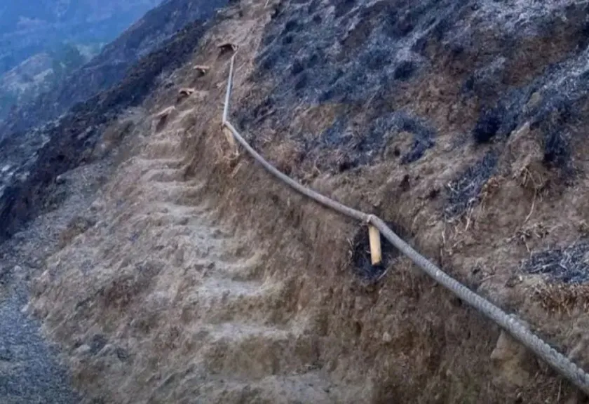
The Mount Rinjani National Park (TNGR) Management Office in West Nusa Tenggara (NTB) has extended temporary closure of the Torean and Senaru hiking trails following forest fires that swept across Bukit Setampol area at Sangkareang Peak. Due to this closure, Mount Rinjani summit hikes via these two routes will not resume in the near future.
This closure is implemented as part of emergency response and ongoing condition monitoring for the fire-impacted zone. As of Wednesday, no confirmed reopening timeline has been set for either the Senaru or Torean trail.
"Both the Senaru hiking route and Torean route remain temporarily closed until further notice," stated Astekita Ardiarsito, Head of Administration Subdivision for the TNGR Management Office, during a press statement in Mataram on Wednesday.
READ ALSO
The Torean Hiking Trail of Mount Rinjani is Temporarily Closed Due to Forest Fires
Mount Raung hiking trails are temporarily closed following forest and land fires.
Mount Anak Krakatau Eruption: These are the Ministry of Tourism's Steps to Protect Tourists and Destinations
For hikers who have already secured e-tickets for entry via Senaru, TNGR management provides two options: reschedule their hiking trip, or reroute both entry and exit points through Sembalun. These options will remain valid until the Senaru trail is officially reopened.
"Hikers currently inside the national park who had planned to exit via Senaru or Torean are being guided to depart through Sembalun instead, strictly following on-site officer directions," he added.
Fire Impact Covers Over 1,000 Hectares
The blaze occurred across the Senaru hiking corridor as well as the Torean and Senaru resort zones. Flames burned through forest surface layers, consuming various vegetation types including mountain pine, dense underbrush, shrubs, high altitude grasses and alpine savannah.
Dry fallen foliage and other ground cover vegetation were also destroyed. While no new active fire ignition points have been detected, field teams continue conducting regular monitoring patrols.
"Based on preliminary monitoring as of 29 September 2026, total burned affected area reached 1,098.75 hectares, with no observed new fire spots or further spread," Astekita reported.
This figure remains provisional. The TNGR Management Office will release updated data once full ground survey results are compiled, including aerial drone documentation and verified boundary mapping of the impacted zone.
"This number is a temporary estimate. Final official figures will be updated following on-site inspections, drone survey documentation, and formal boundary verification of the burned area," he explained.
Officers Remain On Alert For Fire Rekindling
Monitoring of the fire zone is conducted via drone flights at approximately 350 meters altitude. Preliminary observations show remaining heat sources are limited to isolated individual standing trees that had already burned during the main blaze.
Field officers confirmed these remaining hotspots are contained and show no signs of spreading. Nevertheless, maximum vigilance is still maintained to mitigate risk of the fire reigniting.
"Response teams remain fully on standby to anticipate any re-ignition. Security protocols have been strengthened with increased patrols and mandatory baggage screening for all personnel entering the area," he stated.
The fire at Bukit Setampol, Torean Resort, Rinjani Lombok was first reported on Tuesday 22 September. Response and monitoring operations within the affected area remain ongoing.
The absence of new active fire points marks positive progress in the fire containment effort. However, the temporary closure of the Torean and Senaru trails will remain in effect indefinitely, to confirm the zone is fully safe for public hiking activities.










Belum ada komentar. Jadilah yang pertama!