
Mount Rinjani's Senaru Hiking Trail Has Reopened, Five Routes Can Be Traversed
Tuesday, 6 October 2026 | 14:00
Author: Arif S

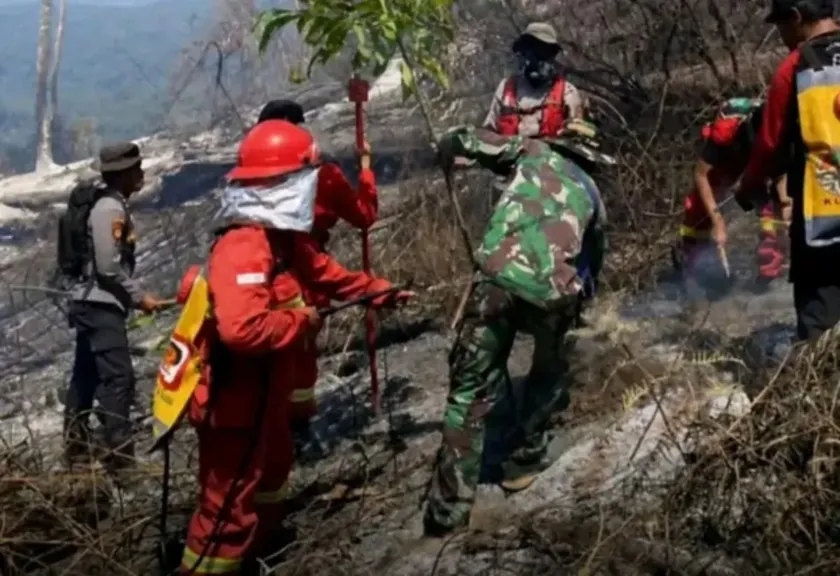
The National Park Mount Rinjani (TNGR) Management Authority of West Nusa Tenggara has officially reopened the Senaru hiking trail in North Lombok Regency, effective 3 October 2026. This route was previously closed temporarily due to Forest Fire incidents. This announcement brings welcome news for hikers intending to explore Mount Rinjani.
The trail reopening was enacted after completion of fire extinguishing operations, joint evaluation and cross-stakeholder assessment processes. TNGR Management has confirmed the area condition is now sufficiently safe to receive visitors once again.
Astekita Ardiarsito, Head of Administration Sub-Division for TNGR, stated the decision was finalized once the fire was confirmed fully extinguished, and all hiking facilities and supporting infrastructure had been inspected to guarantee visitor safety.
READ ALSO
Rinjani From Various Angles: Non-Climbing Destination Stealing the Spotlight
Mount Rinjani Hiking Routes via Torean and Senaru Are Closed, Here Are Alternatives for Hikers
Mount Rinjani Hiking Opened With Limited Access, Online Booking Temporarily Suspended.
"All visitors planning to hike may complete registration online through the eRinjani Application," he stated.
With the Senaru trail back in operation, all five recreational hiking routes within Mount Rinjani National Park are now accessible. Alongside Senaru, hikers may select the Sembalun, Tibanuh, Tetebatu and Aik Berik trails.
"At present, all five hiking routes are open for public use," he added.
Prior to this reopening, all hiking activity on both Senaru and Torean trails had been suspended after wildfires swept the area. The blaze burned multiple vegetation types including mountain pine, scrub brush, shrubs, grass, highland savanna, dry leaf litter and other undergrowth.
The fire ignited at Bukit Setampol, Torean Resort sector of Mount Rinjani, Lombok, on Tuesday 22 September 2026. Response teams conducted extinguishing operations and continuous monitoring to prevent further spread of the blaze.
According to preliminary monitoring compiled as of 29 September 2026, total impacted area is estimated at 1,098.75 hectares. No new fire hotspots or additional burn expansion have been detected at this stage.
TNGR authorities will update this damage figure using verified data from on-ground patrols, drone documentation and formal boundary survey of the affected zone.
"This remains an interim estimated figure. It will be revised following completed field assessments, drone documentation and official verification of the impacted area boundaries," he explained.
Even with the Senaru trail now reopened, heightened alert protocols remain active. Field personnel continue regular monitoring and patrols as a precaution against potential fire reignition within the burned zone.
"Response teams remain on standby for reignition risks. Oversight is being strengthened via scheduled patrols and thorough inspection of all visitor brought items," he noted.
For the hiking community, the Senaru trail reopening restores access to one of the most popular ascent routes for Mount Rinjani. All visitors are reminded that full compliance with national park regulations remains a mandatory requirement for all treks.
Hike registration is processed exclusively via the eRinjani application. With all five routes now operational, visitors have full route options to explore the Mount Rinjani area, while always adhering to published safety protocols and environmental protection guidelines.










Belum ada komentar. Jadilah yang pertama!